
Have you ever wanted to see the bigger picture in a way that feels like you’re soaring high above everything? That’s exactly what a bird eye view offers.
It’s a unique perspective that lets you look down from above, giving you a clear and complete understanding of a place or situation. Whether you’re planning a trip, designing a project, or just curious about how things fit together, knowing what a bird eye view is can change how you see the world.
Keep reading, and you’ll discover how this simple idea can help you make smarter decisions and unlock new insights.

Credit: www.shutterstock.com
Bird Eye View Basics
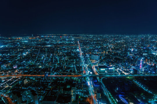
A bird eye view shows a scene from high above. It looks like what a bird would see while flying.
This view helps people understand the layout of places or objects from the top.
Origin And Meaning
The term “bird eye view” comes from how birds see the world while flying. It means looking straight down from above.
This view gives a wide picture of the area, showing details that are hard to see from the ground.
Visual Characteristics
A bird eye view shows objects and places from directly above. It flattens the scene into two dimensions.
- Objects appear smaller and simpler
- Shows the layout and arrangement clearly
- Focuses on shapes and positions
- Does not show height or depth well
Common Uses
This view is common in maps, city plans, and video games. It helps users see the whole area at once.
- Maps and navigation tools
- Architectural and city planning
- Sports strategy and analysis
- Drone and satellite photography
- Board games and video games
Techniques For Capturing Bird Eye Views
A bird eye view shows a scene from high above, looking straight down. It gives a clear picture of an area or object.
There are many ways to capture bird eye views. Each technique uses different tools and technology.
Aerial Photography
Aerial photography uses cameras mounted on aircraft. Planes or helicopters fly over the area to take photos from above.
This method gives detailed images of large areas. It works well for maps, surveys, and land planning.
Drone Technology
Drones are small flying devices with cameras. They can hover and fly low to capture sharp bird eye views.
Drones are easy to use and cost less than manned aircraft. They are popular for real estate, events, and inspections.
Satellite Imaging
Satellites orbit high above the Earth. They take pictures from space, showing very large areas at once.
This technique is useful for weather monitoring, environmental studies, and city planning.
Traditional Methods
Before modern tools, people used tall buildings or hills to get bird eye views. They also drew maps from these views.
These methods are simple but limited. They work best in small areas and clear weather.
Applications Across Industries
Bird eye view shows objects from above. It helps people see large areas clearly.
Many industries use bird eye view for planning and analysis. It gives a clear look at spaces and objects.
Urban Planning And Architecture
Urban planners use bird eye view to design cities and towns. It shows roads, buildings, and parks from above.
Architects use it to plan building placement and landscapes. This view helps avoid mistakes and improves design.
Film And Media
Filmmakers use bird eye view shots to add drama and show scale. It gives viewers a unique perspective of scenes.
Media creators use it in documentaries to explain locations and events clearly. It helps tell better stories visually.
Environmental Monitoring
Bird eye view helps track changes in forests, rivers, and cities. It shows damage from floods, fires, and pollution.
Scientists use it to study land use and wildlife habitats. This view supports conservation and planning efforts.
Gaming And Virtual Reality
Game designers use bird eye view to create maps and levels. It helps players see the whole game area clearly.
Virtual reality uses this view for navigation and exploration. It makes digital worlds easier to understand and enjoy.
Credit: stock.adobe.com
Advantages Of Bird Eye Perspectives
Bird eye view shows a scene from above, like a bird flying high. It helps us see the whole area clearly.
This view is useful in many fields, such as maps, art, and planning. It gives a different way to understand space.
Enhanced Spatial Awareness
Looking from above helps people understand where things are placed. It shows how objects relate to each other in space.
This view makes it easier to see distances and directions. It helps with learning and planning in many areas.
Improved Navigation
Bird eye view helps people find their way better. It shows paths, roads, and landmarks clearly from above.
Maps with this view are simple to read. Travelers and drivers can plan routes faster and avoid getting lost.
- Shows clear routes and intersections
- Highlights landmarks for easier reference
- Helps plan shortest paths
Unique Artistic Views
Artists use bird eye view to create fresh, interesting images. It shows scenes from unusual angles.
This perspective adds depth and detail. It can make art more engaging and different from normal views.
Challenges And Limitations
Bird eye view technology offers a unique perspective from above. It helps in many fields like mapping and surveillance. Yet, this view comes with some challenges and limits.
Understanding these limits is important. It helps users know when bird eye view works best and when it might not.
Technical Constraints
Capturing a clear bird eye view needs good technology. Cameras must have high resolution. The data size can be very large and hard to manage.
Sometimes, the equipment is costly. It may need drones or satellites, which are not always easy to access. Processing images requires strong computers.
- High resolution cameras needed
- Large data size to store and process
- Expensive equipment like drones or satellites
- Powerful computers for image processing
Privacy Concerns
Bird eye view can capture private places without permission. This raises privacy issues for people and businesses. Laws about airspace and data use vary by country.
Unauthorized images can cause mistrust. Protecting privacy needs clear rules and respectful use of bird eye view technology.
- Risk of capturing private property
- Different privacy laws in each country
- Need for clear rules to protect people
- Concerns about misuse of images
Weather And Environmental Factors
Weather affects the quality of bird eye view images. Rain, fog, or clouds can block the view. Wind can make drone flights unsafe or unstable.
Environmental changes like trees growing or buildings being built can alter the view. This means images can become outdated quickly.
- Rain and fog reduce image clarity
- Wind affects drone stability
- Cloud cover blocks satellite views
- Changes in environment cause outdated images
Future Trends In Aerial Perspectives
Bird eye view images and videos give us a new way to see the world. They show scenes from above, offering a fresh look at places.
Technology is changing fast, making aerial views clearer and easier to get. New tools help us explore the skies in smart ways.
Advancements In Drone Tech
Drones are getting better with stronger batteries and sharper cameras. They can fly longer and capture clearer pictures from high above.
New drone designs are smaller and quieter. This helps them work in busy places without disturbing people or animals.
- Longer flight times
- Higher resolution cameras
- Improved stability in wind
- Smaller and quieter models
Integration With Ai
Artificial intelligence helps drones understand what they see. AI can find objects and track changes in real time.
AI also helps plan drone flights for better coverage. It can avoid obstacles and adjust paths for safer flying.
- Object detection and tracking
- Smart flight planning
- Real-time data analysis
- Automatic obstacle avoidance
Expanding Accessibility
More people and businesses can now use bird eye views. Lower costs and easier controls make drones available to many users.
Apps and software help users view and edit aerial images. This expands how bird eye views are used in different fields.
- Affordable drones for beginners
- User-friendly flying apps
- Editing tools for aerial photos
- Use in farming, real estate, and maps

Credit: www.freepik.com
Frequently Asked Questions
What Is The Meaning Of Bird Eye View?
Bird Eye View means seeing an object or place from above. It provides a top-down perspective, like a bird flying overhead. This view helps in understanding layouts, locations, and spatial relationships clearly and effectively.
How Is Bird Eye View Used In Mapping?
Bird Eye View in mapping shows geographic areas from above. It helps users visualize terrain, landmarks, and routes easily. This perspective is essential for navigation, urban planning, and geographic analysis.
Why Is Bird Eye View Important In Photography?
Bird Eye View in photography captures scenes from a high angle. It offers unique compositions and context, showing the environment around the subject. This view adds creativity and depth to photos.
What Industries Benefit Most From Bird Eye View?
Industries like real estate, urban planning, gaming, and surveillance benefit. Bird Eye View helps in planning, monitoring, and presenting spatial information clearly. It improves decision-making and visualization in these fields.
Conclusion
Bird’s eye view offers a fresh perspective on landscapes. It helps in understanding the bigger picture. This perspective is useful in many fields. Photography, mapping, and even strategic planning. It provides insights that ground views can miss. It enables better decisions and creative thinking.
This view can transform how we see our surroundings. People can appreciate the world in new ways. It’s a simple but effective tool. Great for anyone curious about the world. Give bird’s eye view a try. You’ll see things differently.


