
Have you ever wished you could see your neighborhood or favorite places from high above, like a bird soaring in the sky? Google Maps makes this possible with its Bird’s Eye View feature.
It gives you a detailed, angled look at locations, helping you explore streets, buildings, and landmarks in a way that feels almost real. In this guide, you’ll learn exactly how to activate and use Bird’s Eye View on Google Maps.
By the end, you’ll have a new way to see the world around you—clearer and more exciting than ever before. Ready to take your map experience to the next level? Let’s dive in!
Credit: osintteam.blog
Accessing Google Maps
Google Maps lets you see places from above. The bird’s eye view shows a detailed image. You can use it on your computer or phone.
This guide explains how to find the bird’s eye view on Google Maps. You can use different devices to do this.
Using Desktop Browser
Open your preferred web browser on your computer. Go to the Google Maps website by typing maps.google.com in the address bar.
Search for a place or address using the search box. Switch to satellite view to see detailed images from above.
- Click the “Layers” button in the bottom left corner
- Select “Satellite” to change the map view
- Use the zoom buttons or mouse wheel to zoom in
- Drag the map to explore the area
Mobile App Options
Open the Google Maps app on your smartphone or tablet. Use the search bar to find a place you want to see from above.
Tap the layers icon on the top right. Choose “Satellite” to see a bird’s eye view of the area.
- Use pinch gestures to zoom in or out
- Swipe to move around the map
- Tap and hold to drop a pin for more options
Navigating To Desired Location
To see a bird’s eye view on Google Maps, you first need to find the place. Google Maps lets you search for any location worldwide. You can then zoom in to see the area from above.
This guide will help you use the search bar and zoom controls to reach the spot you want to view.
Search Bar Tips
The search bar is where you type the location name or address. Use clear and simple terms to find places faster. You can enter city names, landmarks, or full addresses.
Try these tips to improve your search:
- Use exact street addresses for precise results
- Type city or town names for a broader area
- Include landmarks like “Eiffel Tower” or “Central Park”
- Check spelling to avoid wrong places
Zoom Controls
Zoom controls help you get closer or farther from the location. Use the plus (+) and minus (-) buttons on the screen to zoom in and out. Zooming in shows detailed bird’s eye views.
You can also use your mouse wheel or touch screen gestures for zooming. The right zoom level lets you see buildings, roads, and other features clearly.
- Click + to zoom in closer
- Click – to zoom out wider
- Double-click on the map to zoom in quickly
- Use two fingers to pinch zoom on a touchscreen
Activating Bird’s Eye View
Bird’s Eye View lets you see places from an angled, high-up perspective. This view helps you understand buildings and landscapes better.
Google Maps offers different ways to activate and use Bird’s Eye View. You can switch views to explore the area in more detail.
Switching To Satellite Mode
To start Bird’s Eye View, first switch your map to Satellite Mode. This mode shows real images from above, not just a map drawing.
Look for the “Layers” button on the bottom left or right of your screen. Click it and select “Satellite” from the options.
Using 45-degree View
After switching to Satellite Mode, you can use the 45-Degree View for Bird’s Eye images. This view shows buildings and streets at an angle.
- Click the “3D” button if available.
- Use the mouse or fingers to tilt the map.
- Look for angled images of buildings and landmarks.
- Zoom in for better detail in the 45-degree view.
Alternative Views And Angles
Google Maps also offers other ways to see your location. You can change angles or use Street View for ground-level photos.
| View Type | Description | How to Access |
| Bird’s Eye (45-Degree) | Angled aerial photos showing building sides | Use 3D button, tilt map |
| Satellite | Top-down real images from above | Select Satellite layer |
| Street View | Panoramic ground-level photos | Drag the yellow Pegman icon |
| Map | Standard drawn map view | Choose Map layer |
Adjusting Perspective And Zoom
Bird’s eye view on Google Maps helps you see locations from above. Adjusting perspective and zoom makes the view clearer.
This guide explains how to rotate the map and fine-tune zoom levels for better details.
Rotating The Map
Rotating the map changes the direction you see. It helps to get a better angle on streets and buildings.
- Click and hold the compass icon on the screen.
- Drag the map left or right to rotate the view.
- Release to set the new direction.
- Use this to align the map with your real-world direction.
Fine-tuning Zoom Levels
Zooming in and out changes how close or far you see the map. This helps to spot details or get a bigger picture.
| Zoom Level | View Detail | Use Case |
| High Zoom | Shows buildings and small roads | Check specific places or buildings |
| Medium Zoom | Shows neighborhoods and main streets | Explore local areas and routes |
| Low Zoom | Shows large areas and regions | Get overall location context |
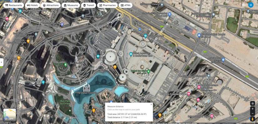
Saving And Sharing Bird’s Eye Views
Google Maps offers a clear bird’s eye view to explore locations from above. You can save these views for quick access later. Sharing them helps others see the exact spot you want to show.
This guide explains how to save and share bird’s eye views on Google Maps easily. You can create bookmarks or send links through social media and other platforms.
Creating Bookmarks
Bookmarks let you keep your favorite bird’s eye views saved in Google Maps. You can return to these spots anytime without searching again.
- Open Google Maps and find the location you want to save.
- Switch to bird’s eye view by zooming in and tilting the map.
- Click the “Save” button below the place name or address.
- Choose a list like “Favorites” or create a new one to store the bookmark.
- Access your saved bookmarks anytime from the “Your places” menu.
Sharing Via Link Or Social Media
You can share bird’s eye views by sending a link or posting on social media. This helps others see the exact map view you want to share.
| Sharing Method | How to Use | Benefits |
| Copy Link | Click the “Share” button, then “Copy Link.” | Send the exact map view via email or chat. |
| Click “Share” and choose Facebook. | Post the view directly to your timeline. | |
| Select Twitter in the share options. | Tweet the bird’s eye view link quickly. | |
| Embed | Get HTML code from “Embed a map.” | Add the map view to websites or blogs. |
Credit: www.androidpolice.com
Troubleshooting Common Issues
Using Bird’s Eye View on Google Maps can sometimes have problems. These issues can stop you from seeing the detailed aerial images.
This guide helps you fix common problems with Bird’s Eye View on Google Maps.
Unavailable Bird’s Eye Coverage
Bird’s Eye View is not available everywhere. Some places do not have this type of imagery yet.
Google Maps updates coverage slowly. New areas may take time to appear in Bird’s Eye View.
- Check if your location supports Bird’s Eye View
- Try searching nearby cities or landmarks
- Use Street View if Bird’s Eye is missing
- Wait for Google to add new images over time
Map Loading Problems
Sometimes the map or Bird’s Eye View does not load correctly. This can cause blank or frozen screens.
Loading issues often happen due to slow internet or browser problems.
- Refresh the page to try loading the map again
- Clear your browser cache and cookies
- Use a different web browser or device
- Check your internet connection speed
- Disable browser extensions that block scripts
Tips For Enhanced Viewing Experience
Viewing a bird’s eye perspective on Google Maps helps you see places clearly from above. This guide shares easy tips to improve your experience. Use simple tools and features to explore better.
Try different ways to control the map view. Small changes can make the images clearer and easier to understand.
Using Keyboard Shortcuts
Keyboard shortcuts speed up how you move and zoom on Google Maps. They make it easy to get a bird’s eye view fast.
- Press the plus (+) key to zoom in closer.
- Press the minus (-) key to zoom out.
- Use the arrow keys to pan left, right, up, or down.
- Hold the Shift key and use arrow keys to tilt the view.
- Press the R key to reset the map orientation to north-up.
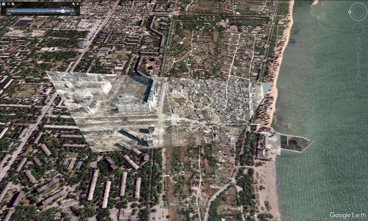
Exploring Historical Imagery
Google Maps lets you see old images of places. This helps compare how areas change over time.
| Feature | How to Use | Benefit |
| Historical Imagery Slider | Click the clock icon to access past images | View changes in landscapes or buildings |
| Timeline Navigation | Drag the slider to choose a year | Compare different time periods easily |
| High-Resolution Photos | Zoom in to see details in old images | Study features not visible in current views |
Credit: support.google.com
Frequently Asked Questions
How Do I Enable Bird’s Eye View On Google Maps?
To enable Bird’s Eye View, open Google Maps and switch to Satellite mode. Then, zoom in to access 45-degree angled imagery, if available for your location.
Can I Use Bird’s Eye View On Mobile Devices?
Yes, Bird’s Eye View is accessible on mobile apps by selecting Satellite view and zooming in. However, availability varies by location and device.
Why Is Bird’s Eye View Not Available Everywhere?
Bird’s Eye View depends on aerial imagery availability. Some regions lack this 45-degree angle data due to privacy or coverage limits.
How Does Bird’s Eye View Differ From Street View?
Bird’s Eye View shows angled aerial images from above, while Street View offers ground-level panoramic photos along streets.
Conclusion
Exploring Google Maps with bird’s eye view is fun and easy. This feature offers a new way to see places. Just follow the steps shared above. You’ll quickly find yourself navigating like a pro. Discover cities, landmarks, and hidden gems from above.
Bird’s eye view gives a fresh perspective. Ideal for planning trips or just exploring. Remember, practice makes perfect. The more you use it, the easier it becomes. Now, you’re ready to explore the world from above. Enjoy your virtual journeys!


